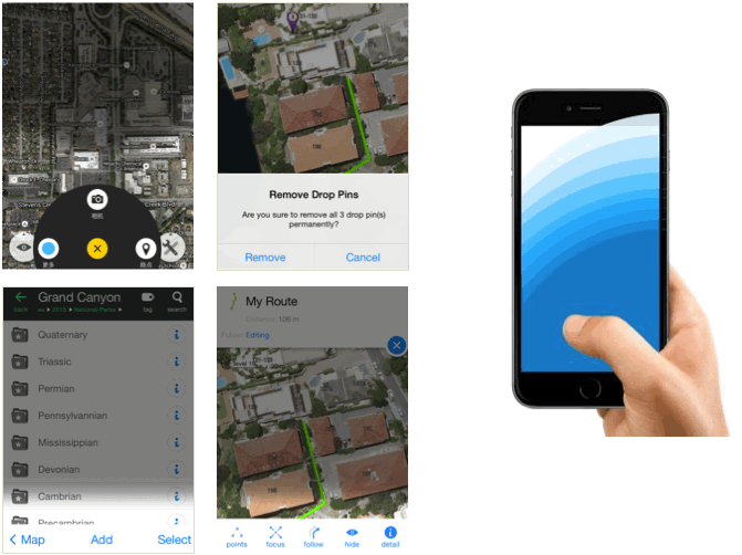
Besides basic map functions such as searching, viewing, Map Plus provides much more, partly shown bellow.
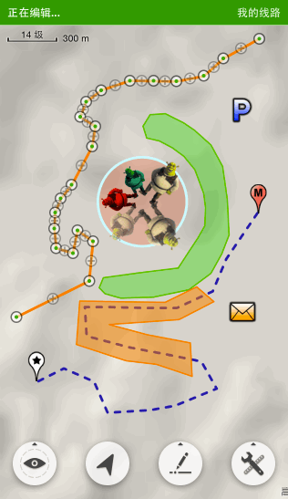
Supports importing vector data from many file format such as KML, KMZ, GPX, Esri Shape(SHP), TAB, GeoJSON, GDB, MPS, CSV, AutoCAD DXF...
Supports all styles of KML, such as icon, label, hotspot, blend color, rotate, scale...
Supports bulk selection and editing for styles and attributes.
Supports dynamic styling by using Feature Class and Conditional Styles.
Supports editing with fingers.
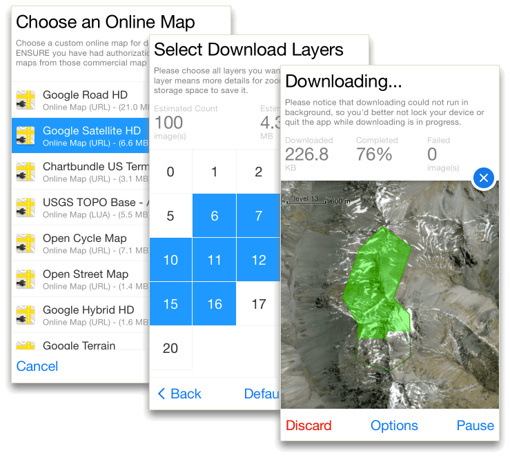
Supports displaying XYZ/WMS/WMTS online map layers provided by any map servers such as Google, Bing, USGS, etc. While the app does not include any map configuration by default, you need to input the url (pattern) of those maps manually.
Supports downloading offline maps from online map layers, which could be viewed without Internet connection.
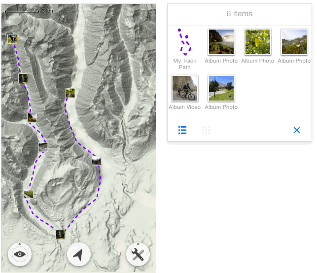
Track your traveling route and save it to your user data.
Supports tracking in the background while you are running other apps or the device is locked.
Supports realtime backup which could recovery all you unsaved tracked data when you are restarting the app from any unexpected termination.
Supports editing a saved track to change the coordinate, altitude and timestamp of any tracked point, or divide a track into two.
Supports loading and displaying photos and videos from your iOS photo album onto the map.
Supports customized markup with text and shapes on photos.
Many functions are designed and enhanced for dealing with photos, which provide you a much easier and convenient way to manage and view them.
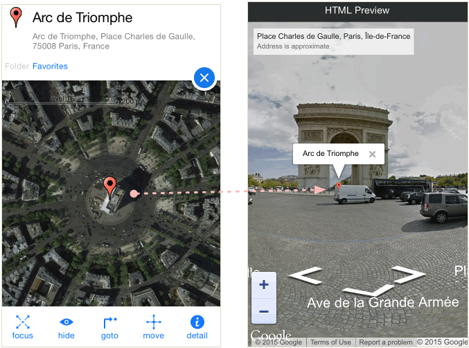
Supports street view for world wide cities and roads, including street views for Mainland China.
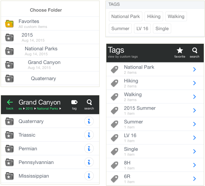
Custom multi-level folders and tags enable you to manage huge amount of data easily. You can copy, move or make shortcut links of features among different folders.
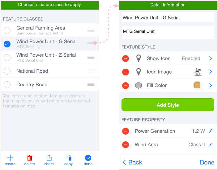
You can create custom feature classes combined with different styles, tags and custom properties. A feature class could be applied to multiple selected features/items all at once, and you can export and share your feature classes with others. The feature class makes all kinds of bulk editing become so convenient and efficient.
Using conditional styles, label expressions and script properties to get dynamic styles and content of attributes.
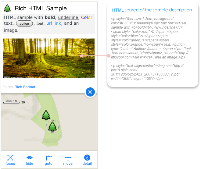
Supports using HTML as the feature's description/note, in order to show a rich formatted content with web page components of special fonts, colors. tables, web links, images, javascripts and css.
Users can use HTML and JS to get the customized UI for selected features, and are able to edit custom properties with special JS in these UI.
Supports using long-press and dragging gestures to insert, edit, delete points, or change the center, radius, region, etc.
Custom Editing Menu enables you to fast create features with same styles and properties.

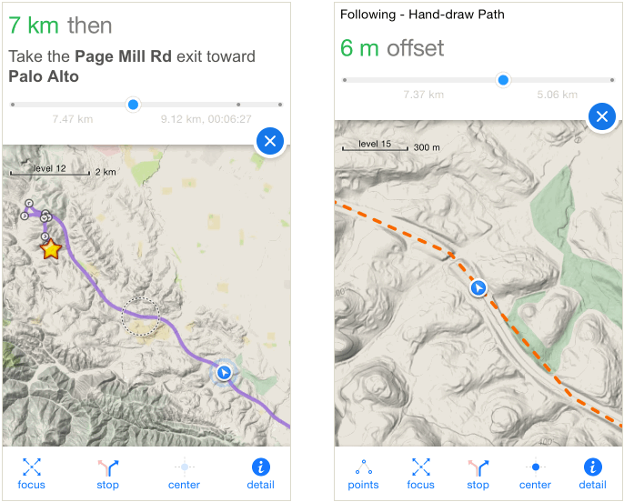
Following a direction route provides you the step-by-step realtime instructions besides distance and duration information; Following a common path provides you the realtime offset from the path and left distance to the terminal point.
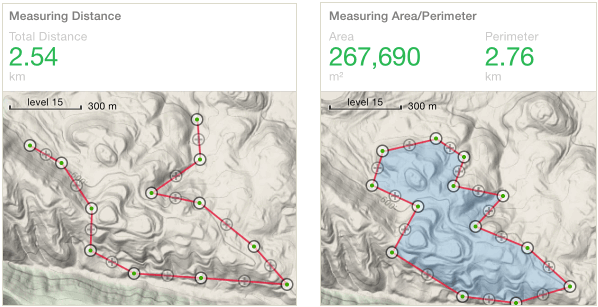
Supports measuring distance, area, perimeter on map. All measuring point could be edited after added.
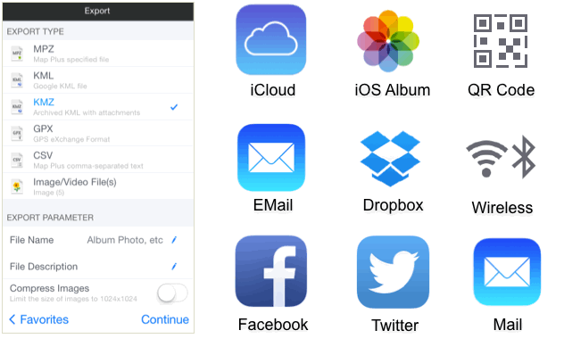
Supports exporting data to files of KML、KMZ、GPX, etc, and sharing these files to iCloud, Twitter, iOS Album, Email, other apps like Dropbox, or save them on your desktop computer.
You can also use Wi-Fi or Bluetooth to transfer data between devices.
Optimized for one-hand operation, makes it more convenient to use while riding or driving. And brings better experience for using on large phones such as iPhone 6 Plus.
